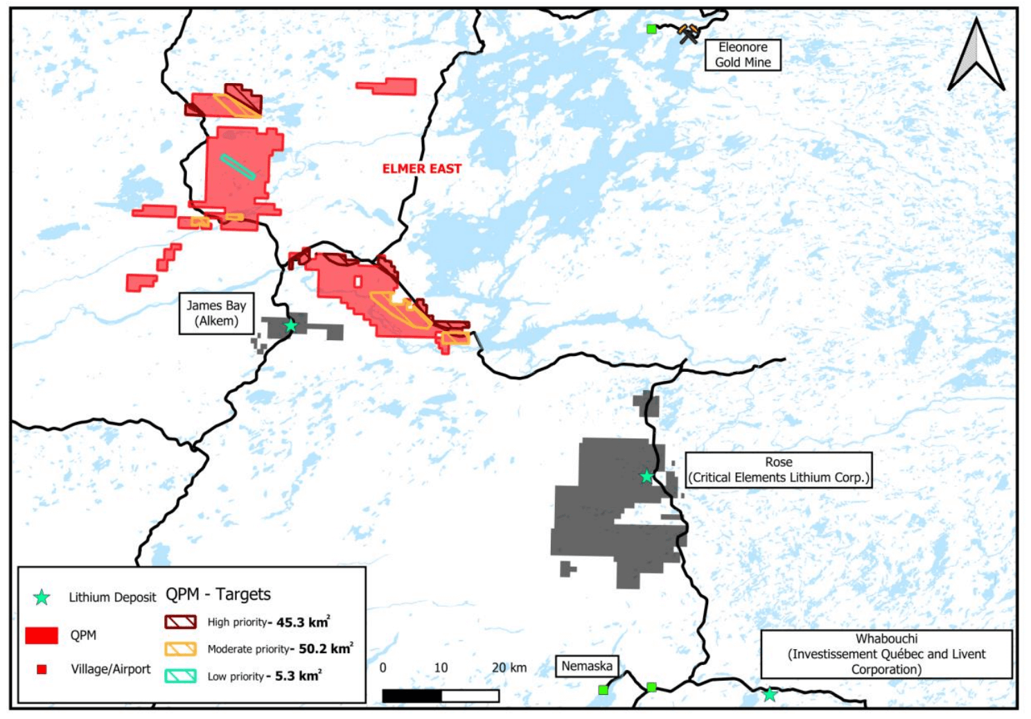
Location map of QPM’s James Bay projects and lithium targets
August 2023 – Detailed lithium targeting completed by ALS GoldSpot Discoveries Ltd.
High priority target areas totaling 125 km2identified with pegmatite rocks on all projects.
Many target areas located near advanced projects and recent significant lithium discoveries, remain to be prospected.
High priority lithium targets have been identified following a detailed lithium targeting study on all exploration projects.
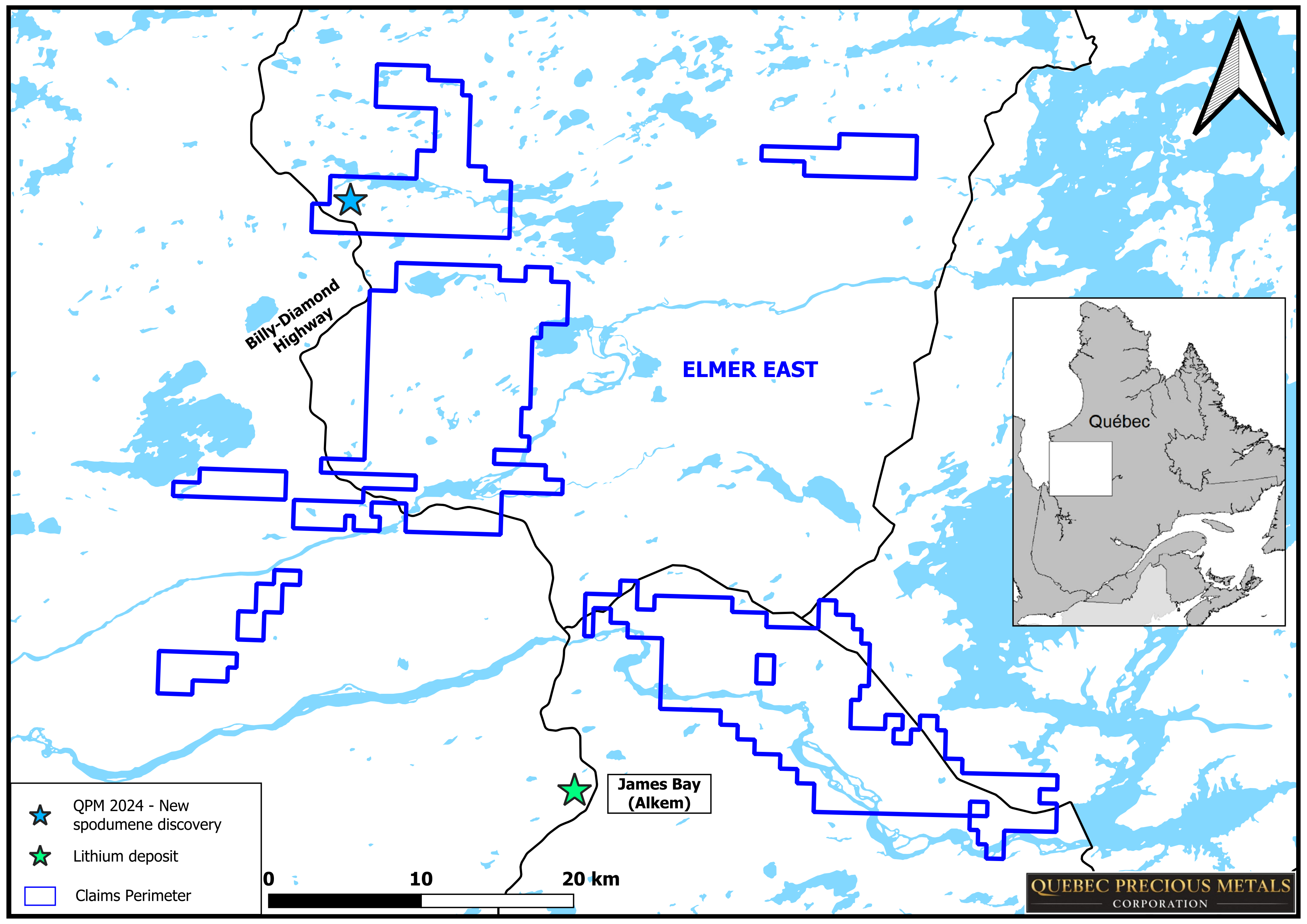
Ninaaskumuwin spodumene discovery
About 1 km from Billy Diamond paved highway
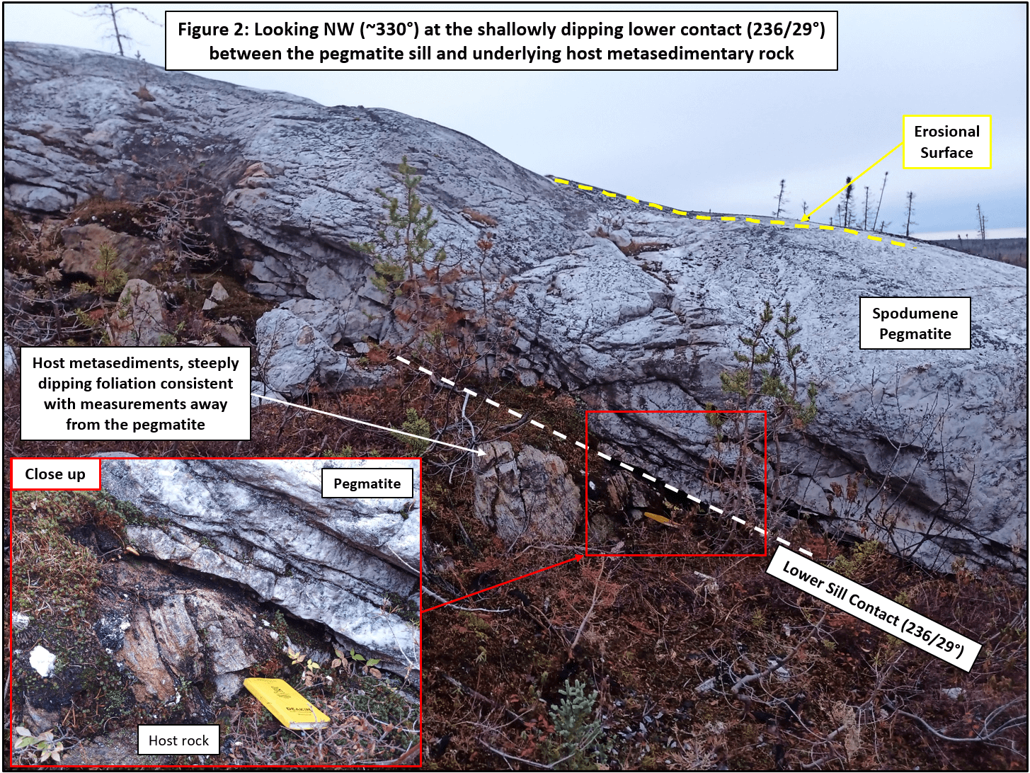
Length 175 m, width 42 m, at the surface
Contains 15-20%, 3-55 cm long spodumene crystals
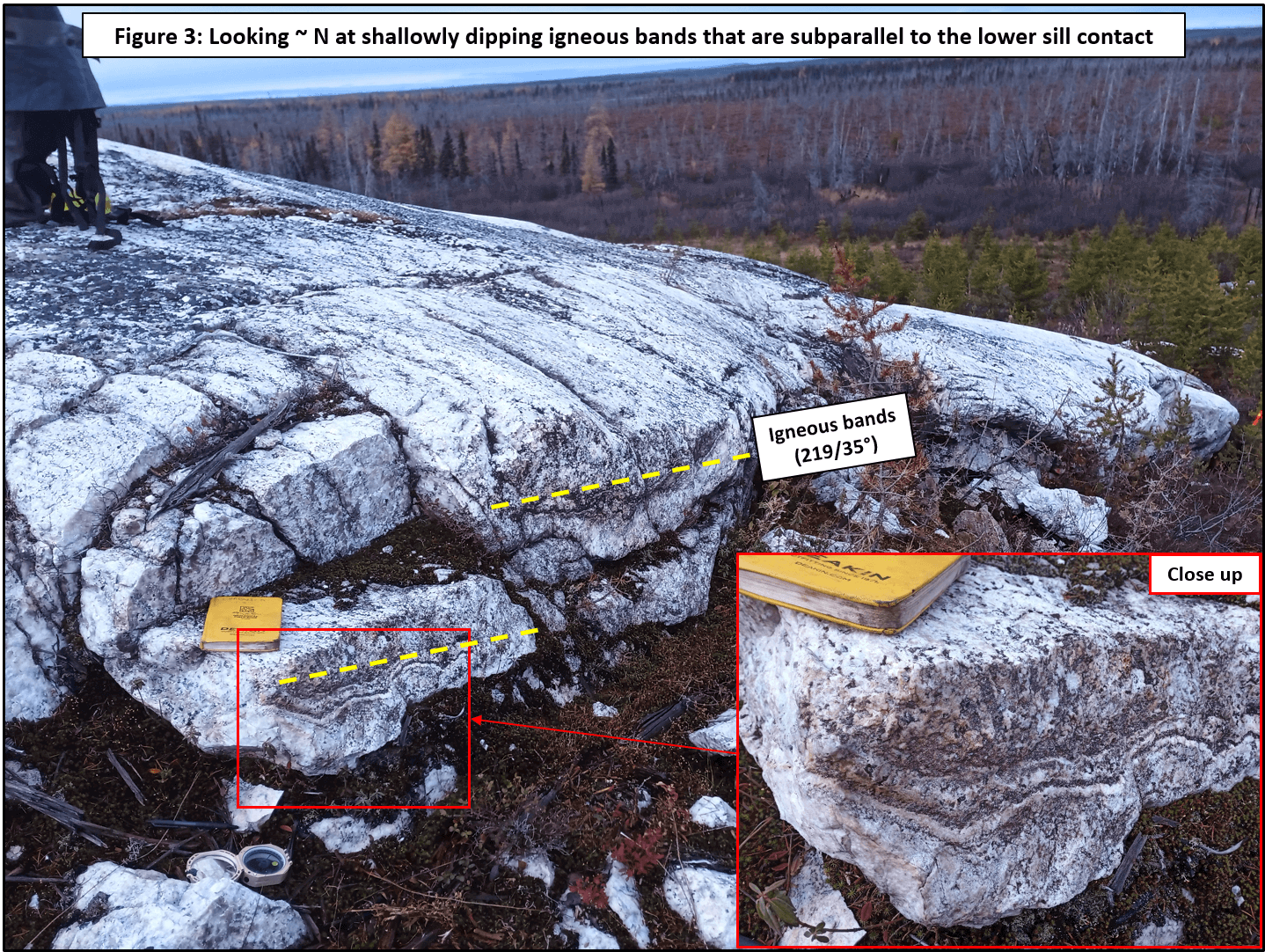
Shallowly dipping sill-estimated thickness about 5 m
Drilling-ready to validate discovery to test down-dip extent of the sill, and presence of potential stacked sills
Carry out geological mapping in and around the discovery outcrop and collect additional structural measurements
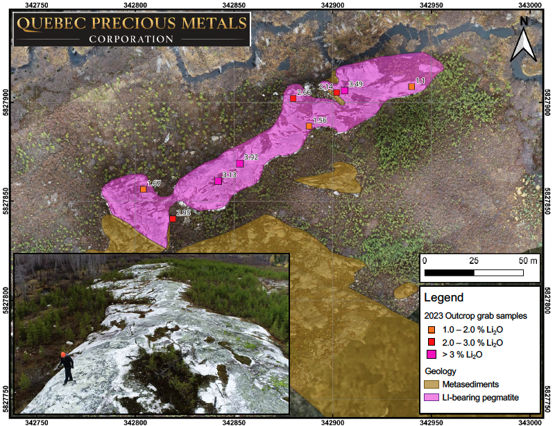
October 2023 – Discovery of Ninaaskumuwin prospect with up to 3.92% Li2O, drill-ready
Location map of the Ninaaskumuwin lithium prospect discovery outcrop
1:1000-scale map of Ninaaskumuwin lithium discovery outcrop showing the locations of reported grab samples and the orientation of the prospective pXRF trend. Note the aerial photograph, looking to the NE, shows the extent of spodumene pegmatite in outcrop (white to light-grey rock)
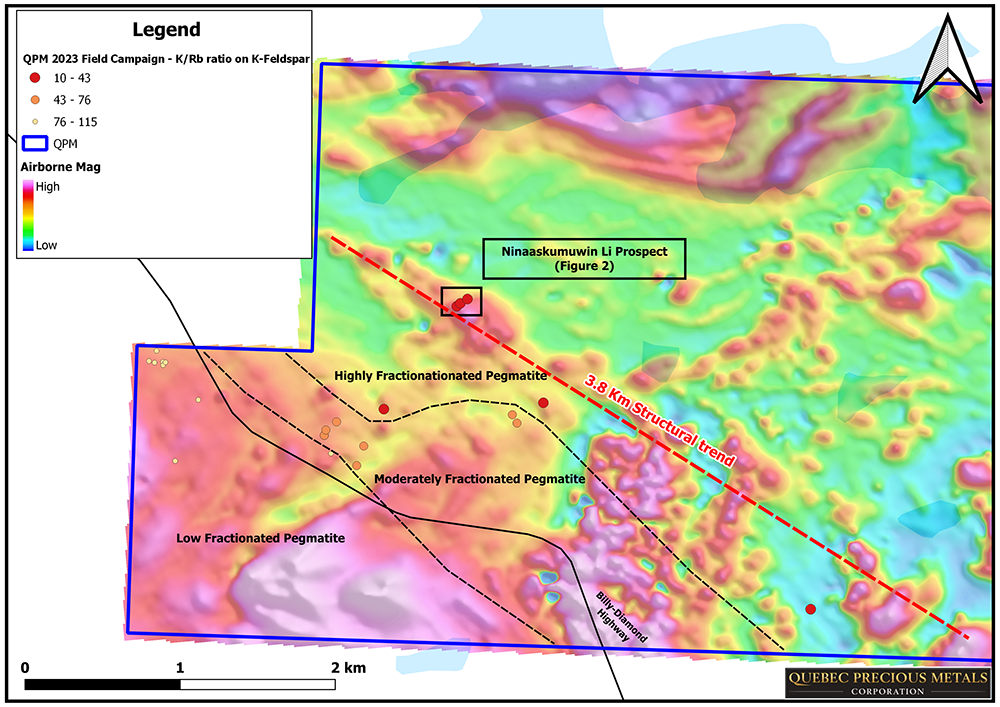
Based on the lithium assays and the fractionation level of the pegmatitic material, derived from the pXRF K-Rb ratios for muscovite and K-Feldspar, the surface mineralization has the potential to extend along a NW-SE 3.8 km-long trend
Map showing the location of the discovery outcrop and the 3.8 km-long prospective pXRF trend, overlaid on airborne magnetic data
Target areas sampling aims to demonstrate the lithium potential of QPM’s projects in a district that has some of the largest spodumene pegmatite resources in the world.
Our website uses cookies to provide you with an optimal and relevant experience. By accepting, you give your consent in accordance with our privacy policy.Accept