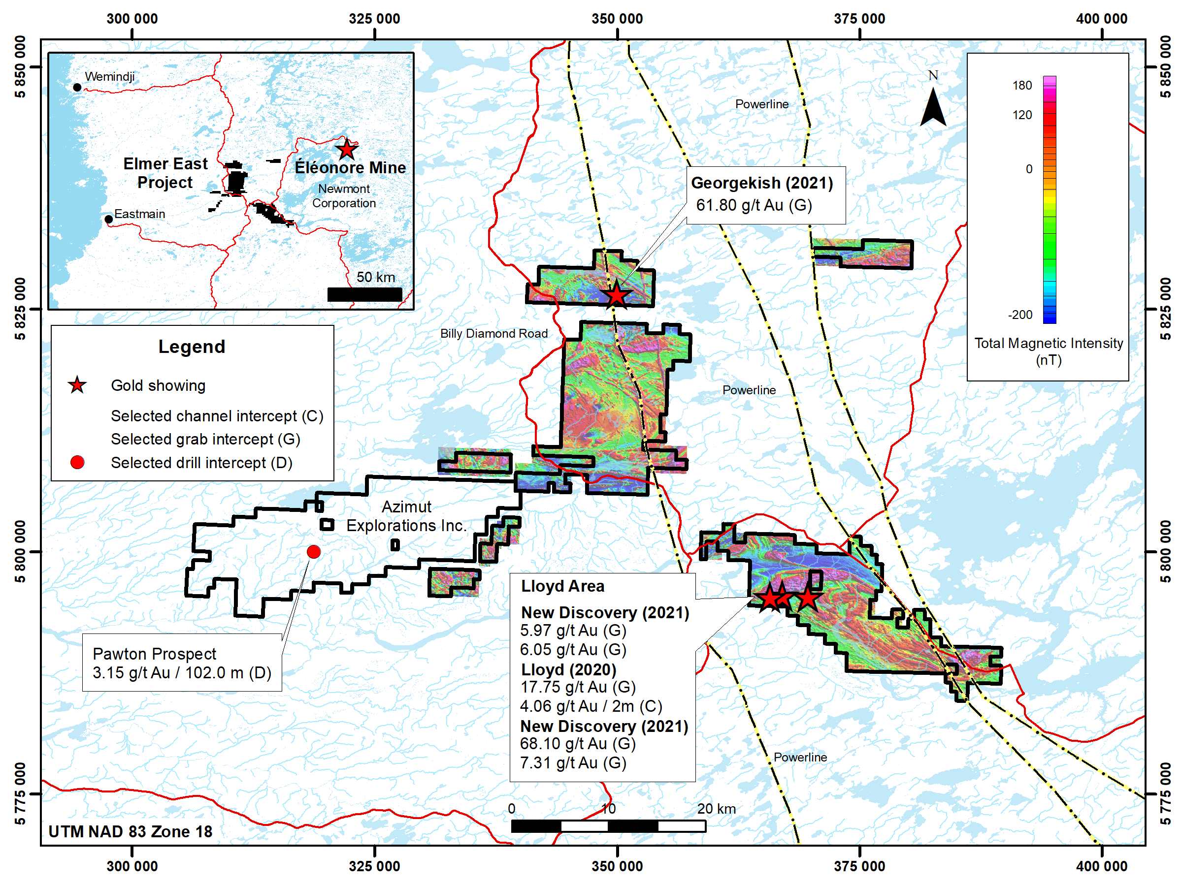
Elmer East Project
QPM’s 100% owned Elmer East project is located along trend from the recent Patwon prospect gold discovery made by Azimut Exploration Inc. on its Elmer project located in the Eeyou Istchee James Bay territory, Quebec. The project has strong gold potential totalling 929 claims (488.4 km2) and includes the adjacent Annabelle block (formerly Annabelle project), and the Opinaca Gold West block (formerly Opinaca Gold West project). The western part of the Elmer East project is contiguous to Azimut’s project.
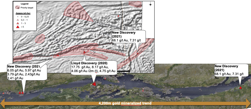
Prior to the summer of 2020, a high-resolution helicopter-borne mag survey was completed and GoldSpot Discoveries Corp. carried out a geological interpretation for QPM to evaluate the gold prospectivity using methods based on Artificial Intelligence. The compilation of over 30,000 outcrop observations combined with over 12,000 lithogeochemical samples allowed a revision of the existing large-scale geological mapping, which resulted in the reinterpretation of the regional geological map. This work highlighted the common geological characteristics of the project with the Éléonore gold mine. Prospecting of the exploration targets identified led to two high-grade gold discoveries: Lloyd and Georgekish.
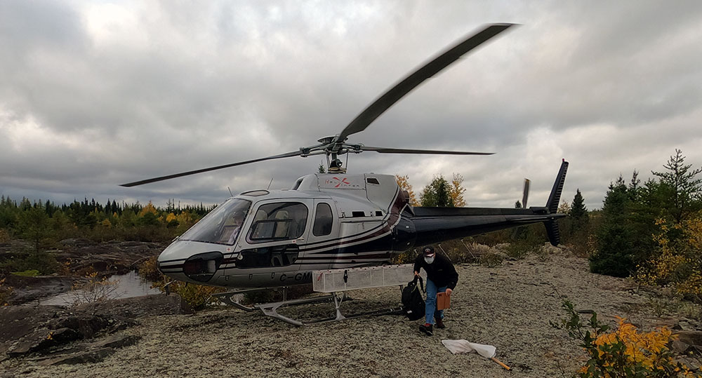
The project is accessible via helicopter support from km 381 on the Billy Diamond paved road where year-round accommodation and logistical support are available.
Latest Update
Geology and Mineralization
The project consists of different parts of the Eastmain volcano-sedimentary belt. The Opinaca Gold West claim block and Opinaca Gold East block are located on the eastern edge of the Duxbury batholith and are composed of the Bernou and Pilipas formations.
The Central Block is located along and north of the Opinaca River straddling a contact between the Duxbury batholith and the Kauputauch formation.
The Annabelle block lies along the Eastmain River for more than 25 km and straddles the contact of the Kapawasatish batholith to the north and the Kawaschusi and Wabamisk formations to the south. Metamorphism generally varies between greenschist and upper amphibolite.
The geological characteristics of the project are as follows:
- The geological characteristics of the project are as follows:
a volcano-sedimentary sequence, comprising from base to summit, basalts, conglomerates, sandstone-grauwacke and paragneiss, all intruded by several felsic intrusions; - a structural complexity with zones of intense folding and shearing;
- felsic and sedimentary volcanic units dated to around <2709 Ma; and
- a major variation of the metamorphic gradient from greenschist to upper amphibolite.
Exploration
At the Lloyd and Georgekish discoveries, results received from surface sampling programs confirmed new gold mineralized systems with several high-grade grab sample values.
At the Lloyd discovery, the exploration work shows a 4.5 km long gold-bearing structure with high grades that remains open to extend mineralization at depth. Processing of aeromagnetic and orthophotos/LiDAR data defines dilatant zones along the structure in a sinistral strike-slip system and connected with dykes. The recommended follow-up program consists of Induced Polarization survey to better define the structure’s high-priority gold targets followed by drilling.
At the Georgekish discovery, the geophysical and litho-structural interpretation carried out highlights major NW trending gold structures that border folded volcano-sedimentary units. This suggests that the lithologic contrast located near anticlinal fold axes are the best targets for gold mineralization. Only the southern part of the discovery area has been prospected. Additional prospecting is recommended over the NW trending structures.
Lloyd Showing
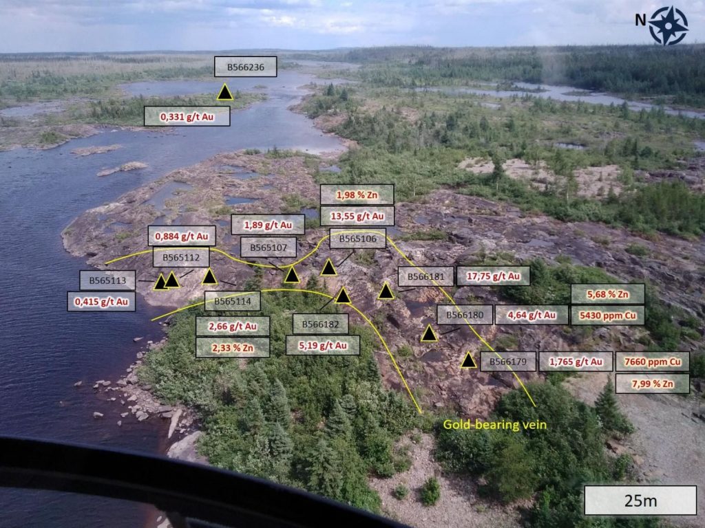
Results received from 2020 summer surface sampling program confirmed a new gold mineralized system with several new high-grade grab samples.
Surface Sampling Highlights
| Lloyd discovery |
|---|
| 4.06 g/t Au, 38.9 g/t Ag, 1.72 % Zn, 1.88 % Pb over 2.0 m (channel R4) |
| 1.77 g/t Au, 12.3 g/t Ag, 0.30 % Zn, 0.78 % Pb over 1.0 m (channel R9) |
| 1.73 g/t Au, 10.3 g/t Ag, 1.00 % Zn, 0.49 % Pb over 1.0 m (channel R8) |
| 1.18 g/t Au, 10.2 g/t Ag, 0.52 % Zn, 0.71 % Pb over 1.0 m (channel R7) |
| 0.96 g/t Au, 19.5 g/t Ag, 1.66 % Zn, 0.51 % Pb over 2.0 m (channel R3) |
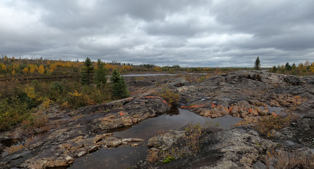
- Outcropping over a distance of 60 m near the Eastmain river and remains open in all directions.
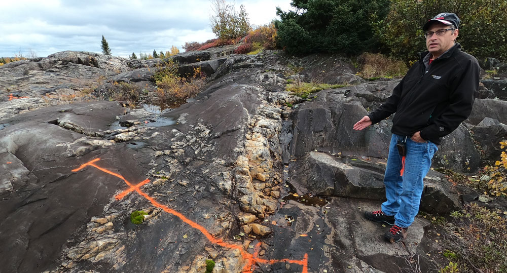
- Quartz vein system 1 to 2 m wide grading up to 17.75 g/t Au, with galena, sphalerite and chalcopyrite was discovered by prospecting high priority targets previously generated with the assistance of GoldSpot Discoveries Corp.
- Another anomalous quartz vein with 0.33 g/t Au was also sampled 400 m east of the initial discovery, following the same interpreted regional scale fault, demonstrating the continuity of the new gold and base metals system.